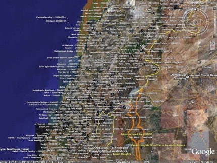
Google Earth map of attacks on Lebanon
People at this website have worked very hard to create a layered map for Google Earth showing as many of the attacks on Lebanon as they have been able to account for through media coverage. Just download the file (which I am caching here because a lot of people might want to see it), install it and Google Earth and follow the links (there's a lot of them as you can see from the pic below - click it to see it full-size.)
If you look into some of the options you have, not only can you see the day-by-day attacks but also other information such as the position of Israeli army positions in Northern Israel (often close to civilian areas, by the way), the spread of the oil spill off Lebanon's coast, minute-by-minute summaries of each day of the war, and more. This map has been deemed so useful that the UN is reportedly using it to plan humanitarian efforts.

If you look into some of the options you have, not only can you see the day-by-day attacks but also other information such as the position of Israeli army positions in Northern Israel (often close to civilian areas, by the way), the spread of the oil spill off Lebanon's coast, minute-by-minute summaries of each day of the war, and more. This map has been deemed so useful that the UN is reportedly using it to plan humanitarian efforts.

